wilddrone / Image credits

Image credits

Copyright in images and publications remains with the credited rights holders. A source attribution does not confer a general licence to reuse the material.

Night camera-trap photograph of a deer in woodland, with a colour inset of the installed camera and aerial.

Night camera-trap photograph of a deer in woodland, with a colour inset of the installed camera and aerial.

Published in Adrian Meyer's SNCF article; no separate photographer credit visible.

No explicit open licence displayed.

The Hidden Forest: false-colour woodland orthomosaic near Bad Säckingen; turquoise water and roads, orange and blue tree crowns, intact irregular survey footprint.

The Hidden Forest: false-colour woodland orthomosaic near Bad Säckingen; turquoise water and roads, orange and blue tree crowns, intact irregular survey footprint.

Adrian Meyer; named credit on the media page and in Horizonte.

CC BY-NC-ND 2.0 on wilddrone.ch/medien/.

Composite scientific figure: railway photograph, segmentation result, and an aerial map with linked camera insets and crossing detections.

Composite scientific figure: railway photograph, segmentation result, and an aerial map with linked camera insets and crossing detections.

Source caption explicitly names Imajnet; figure published in Adrian Meyer's SNCF article.

No explicit open licence displayed; underlying Imajnet and map imagery may have separate provider terms.
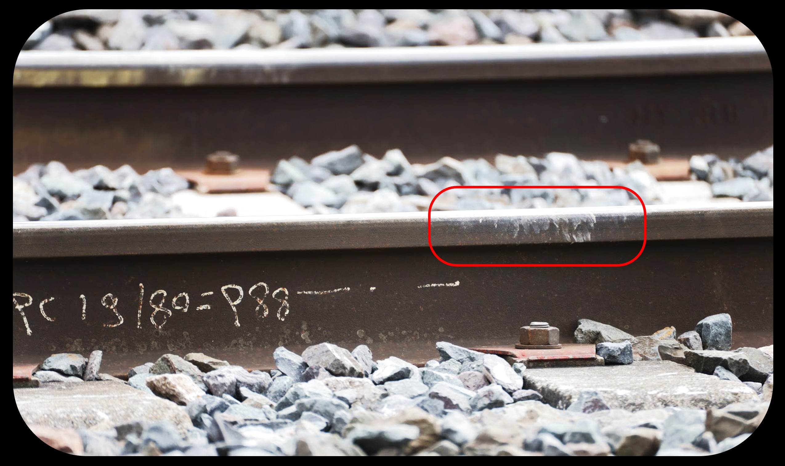
Close-up photograph of mud deposits on a railway rail, highlighted by an existing red outline.

Close-up photograph of mud deposits on a railway rail, highlighted by an existing red outline.

Published in Adrian Meyer's SNCF article; no separate photographer credit visible.

No explicit open licence displayed.
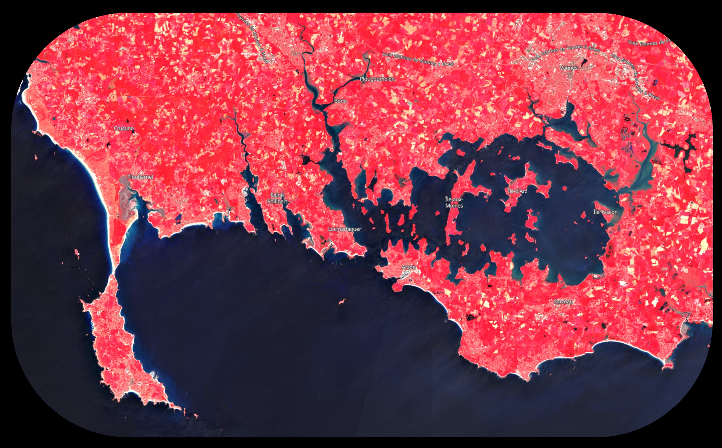
False-colour Sentinel-2 view of the Gulf of Morbihan in Brittany, with bright red vegetation and dark coastal waters.

False-colour Sentinel-2 view of the Gulf of Morbihan in Brittany, with bright red vegetation and dark coastal waters.

Caption names ESA Sentinel-2; rendering published in Adrian Meyer's SNCF article.

No explicit licence for this rendered and labelled composite displayed on the page.
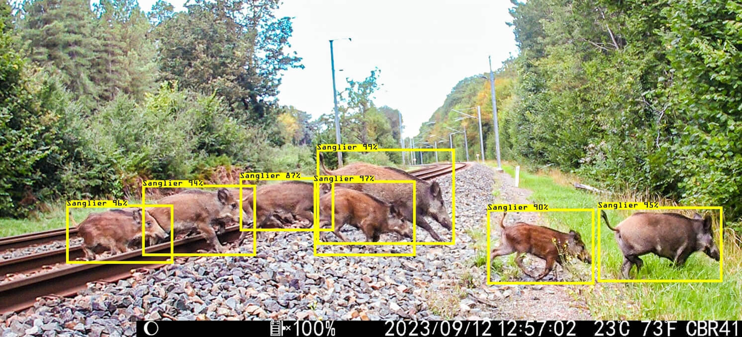
Existing AI illustration of the same boar group, with yellow bounding boxes and French species/confidence labels.

Existing AI illustration of the same boar group, with yellow bounding boxes and French species/confidence labels.

FHNW caption: Bild: Adrian Meyer.

No explicit open licence displayed in the FHNW story.
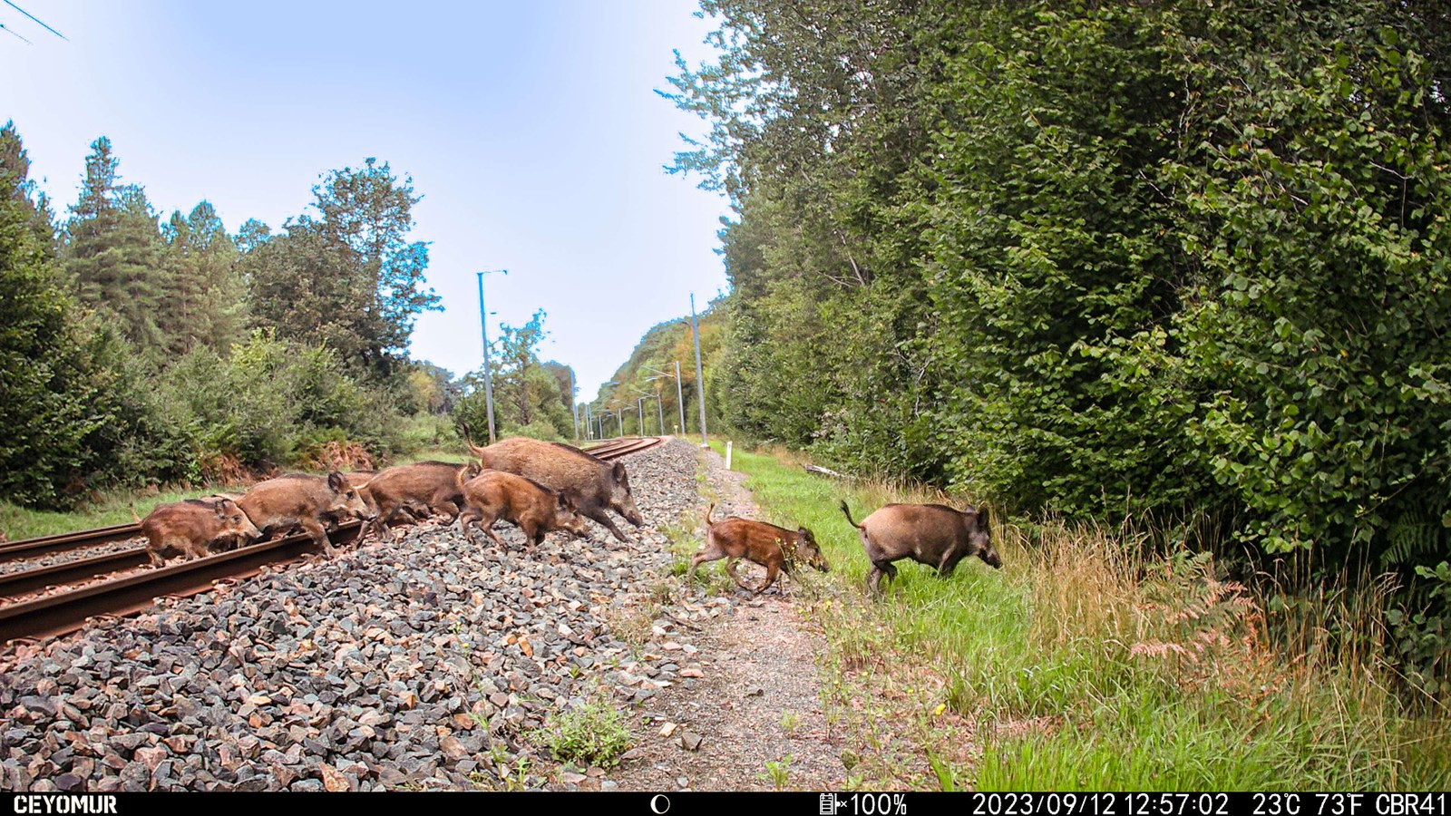
Daytime camera-trap photograph of a wild-boar group crossing the railway amid woodland; strong horizontal landscape composition.

Daytime camera-trap photograph of a wild-boar group crossing the railway amid woodland; strong horizontal landscape composition.

FHNW caption: Bild: Adrian Meyer.

No explicit open licence displayed in the FHNW story.
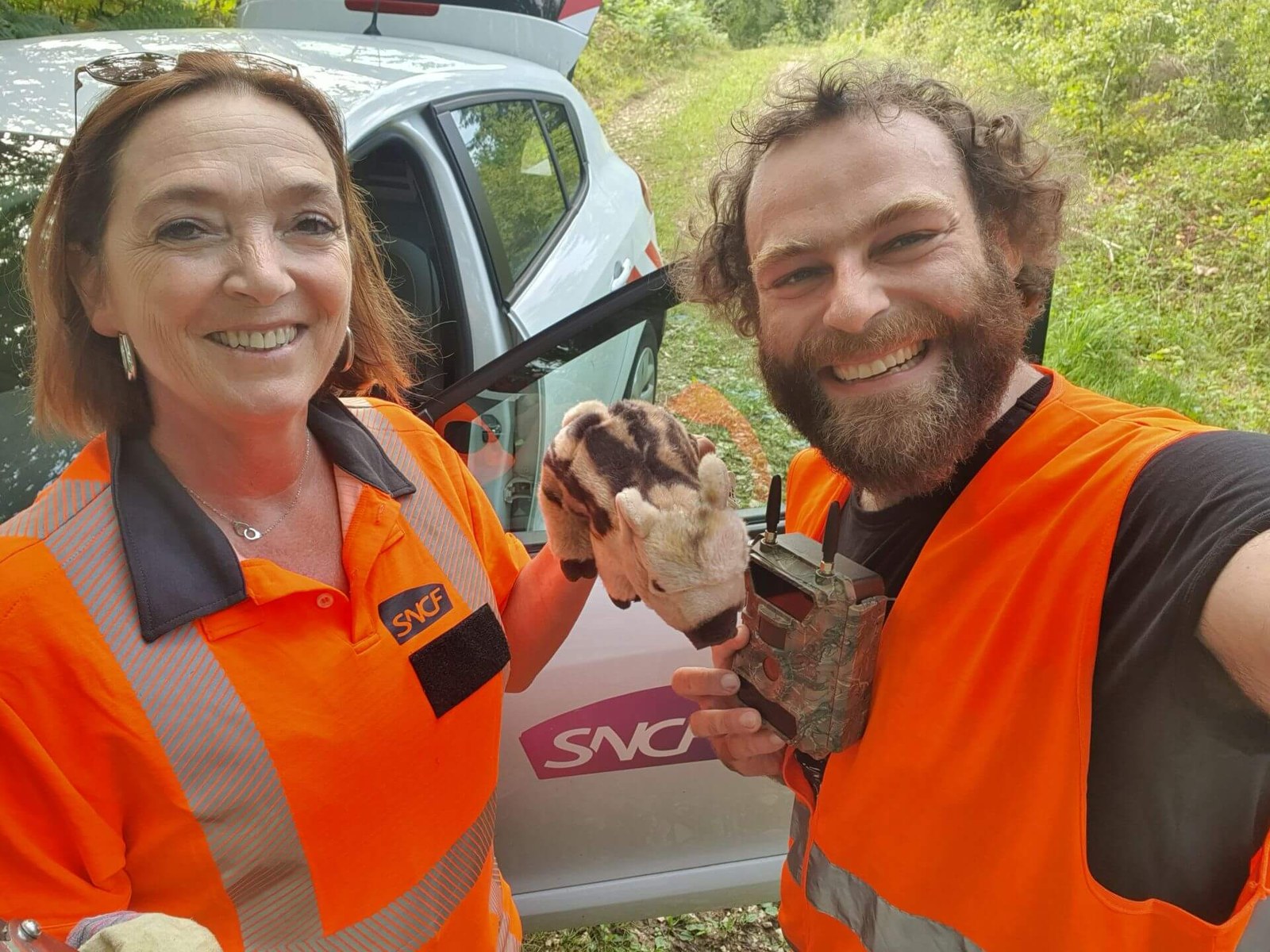
Sylvie Perna and Adrian Meyer in orange SNCF field gear, beside a vehicle, holding a camera trap and a plush wild boar.

Sylvie Perna and Adrian Meyer in orange SNCF field gear, beside a vehicle, holding a camera trap and a plush wild boar.

FHNW caption names Sylvie Perna and Adrian Meyer; Bild: Adrian Meyer.

No explicit open licence displayed in the FHNW story.

Public France-wide SNCF study-area/risk map with railway network, high/low-risk hexagons, regional labels, legend and scale.

Public France-wide SNCF study-area/risk map with railway network, high/low-risk hexagons, regional labels, legend and scale.

FHNW caption: Karte: Adrian Meyer. Image itself: © Adrian Meyer, FHNW.

No explicit open licence displayed.
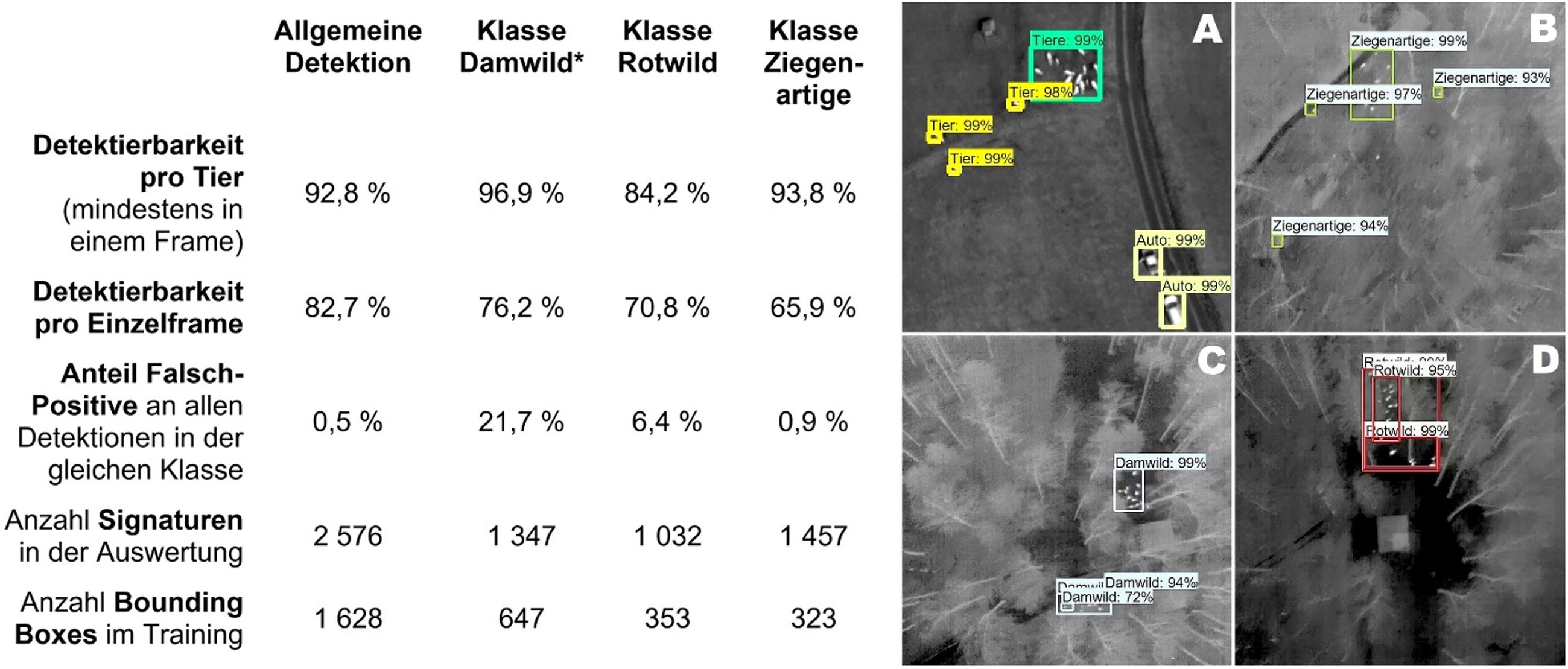
Published results figure: quantitative detection table and four grayscale thermal images with actual Faster R-CNN boxes for animals and species.

Published results figure: quantitative detection table and four grayscale thermal images with actual Faster R-CNN boxes for animals and species.

Scientific figure in the paper by Adrian F. Meyer, Natalie Lack and Denis Jordan, FHNW.

No explicit open licence displayed.

Original thermal comparison strip of fallow deer: six camera angles and views beside/under leafless vegetation.

Original thermal comparison strip of fallow deer: six camera angles and views beside/under leafless vegetation.

Scientific figure in the project paper by Adrian F. Meyer, Natalie Lack and Denis Jordan, FHNW; no separate image creator credit.

No explicit open licence displayed.

Existing visual explainer combining Hidden Forest, an eBee drone, thermal images, animal-detection examples and a neural-network architecture schematic.

Existing visual explainer combining Hidden Forest, an eBee drone, thermal images, animal-detection examples and a neural-network architecture schematic.

Published on Adrian Meyer’s website; incorporates the author's project imagery, a senseFly product image and a network diagram. The paper credits an Inception-v2 subdiagram to Alemi 2016.

No licence displayed for the composite. Hidden Forest has separately stated CC BY-NC-ND terms; other incorporated material has separate provenance.

UAV methods composite: DJI drone cutout, thermal deer panels at six view angles, and a 3D photogrammetric reconstruction with camera positions.

UAV methods composite: DJI drone cutout, thermal deer panels at six view angles, and a 3D photogrammetric reconstruction with camera positions.

Published in Adrian Meyer's SNCF article. DJI branding visible on drone cutout; no separate product-photo credit.

No explicit open licence displayed; includes third-party product imagery.
Existing black contact card with circular Adrian Meyer portrait and baked-in contact text; not a fieldwork photograph.

Existing black contact card with circular Adrian Meyer portrait and baked-in contact text; not a fieldwork photograph.

Name is present; photographer is not credited.

No explicit open licence displayed.
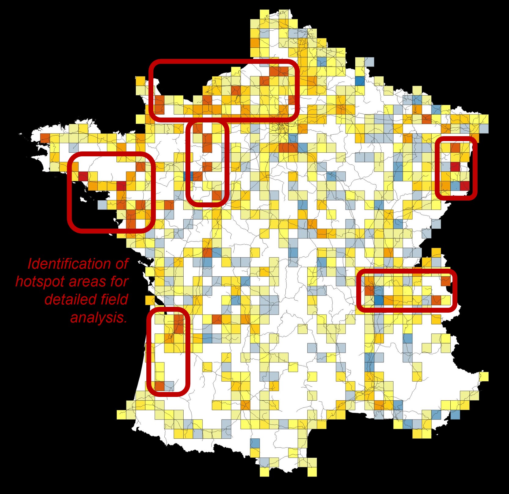
France grid map of a preliminary ARIMA forecast for 2024 based on 2015–2023 incident data, with fieldwork regions outlined.

France grid map of a preliminary ARIMA forecast for 2024 based on 2015–2023 incident data, with fieldwork regions outlined.

Published in Adrian Meyer's SNCF article.

No explicit open licence displayed.
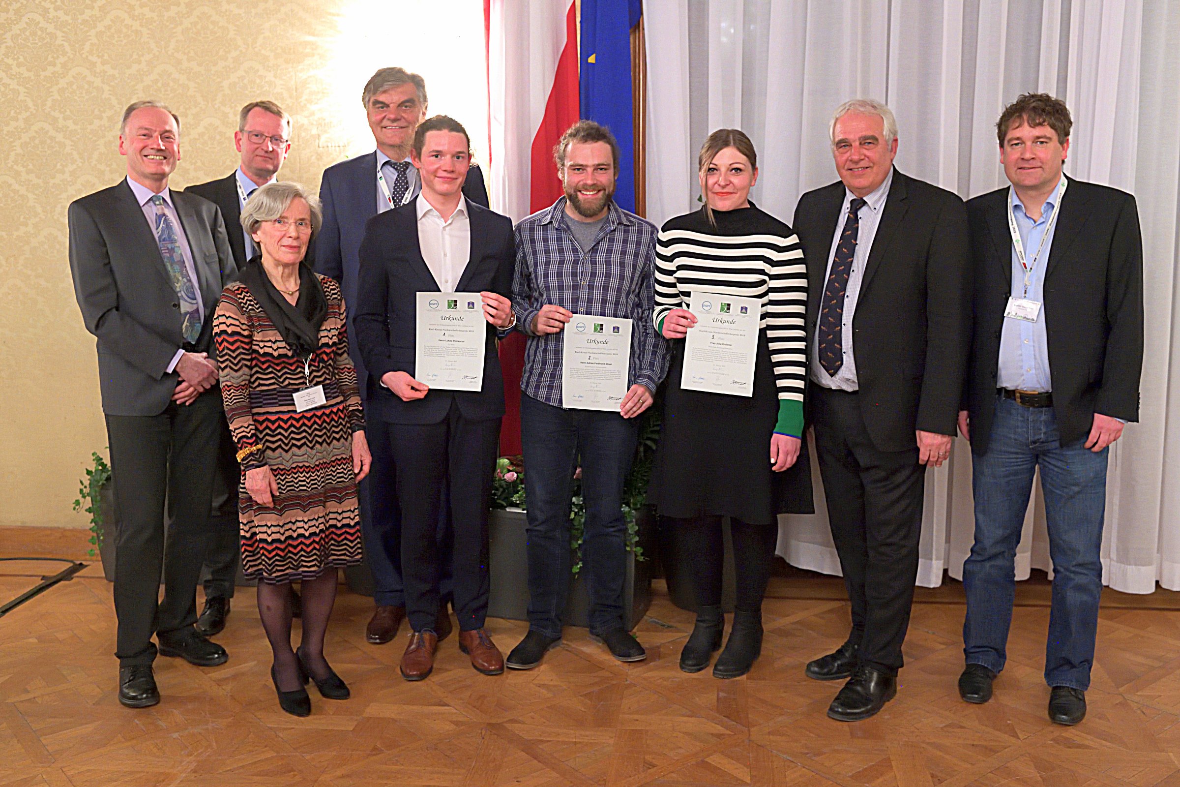
Group photograph from the Karl Kraus award ceremony in Vienna, with Adrian Meyer holding the second-prize certificate.

Group photograph from the Karl Kraus award ceremony in Vienna, with Adrian Meyer holding the second-prize certificate.

Media page caption identifies award and recipients; no photographer credit visible.

No explicit open licence displayed.

French-language schematic of the 2023 proposed architecture connecting satellite series, mobile mapping, field data and auxiliary data to risk outputs.

French-language schematic of the 2023 proposed architecture connecting satellite series, mobile mapping, field data and auxiliary data to risk outputs.

Published by Adrian Meyer on the SNCF project page.

No explicit open licence displayed.
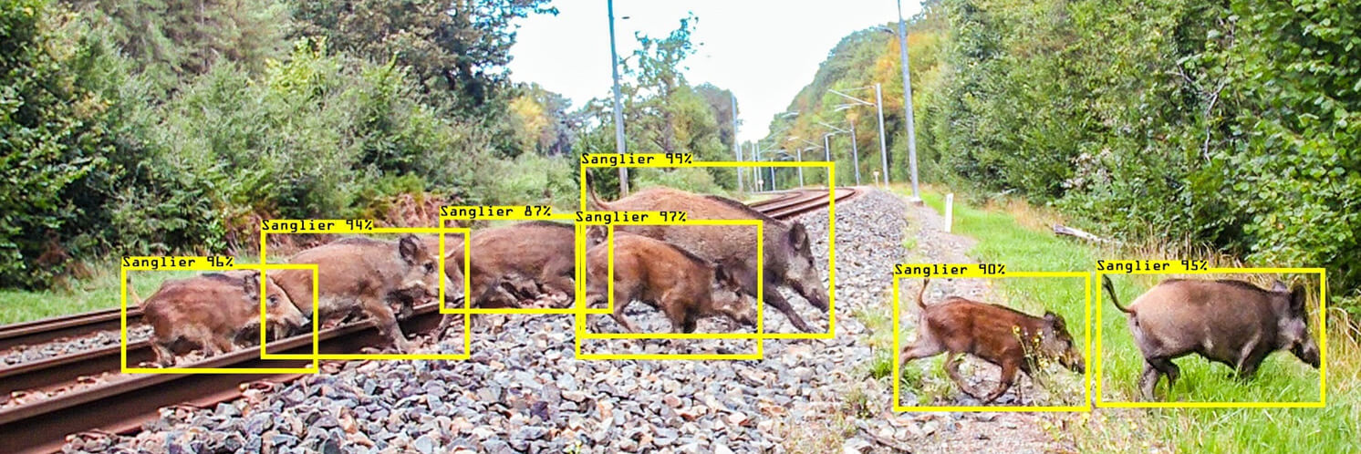
Wide published crop of the daytime boar crossing photograph with existing yellow detection boxes.

Wide published crop of the daytime boar crossing photograph with existing yellow detection boxes.

The FHNW story credits the paired camera-trap photograph and detection illustration to Adrian Meyer.

No explicit open licence displayed in the FHNW story.
Existing SNCF promotional header with baked-in title, portrait and institutional logos over Hidden Forest; not a fieldwork photograph.

Existing SNCF promotional header with baked-in title, portrait and institutional logos over Hidden Forest; not a fieldwork photograph.

Adrian F. Meyer named in the graphic; FHNW and SNCF logos visible.

No separate licence displayed; includes Hidden Forest and institutional marks.

Published COLLEMBOT example with the original segmentation masks and labels over a springtail image.

Published COLLEMBOT example with the original segmentation masks and labels over a springtail image.

COLLEMBOT project team; published in Adrian Meyer’s repository.

AGPL-3.0, source repository licence. Original figure retained without content changes.

Published swimming-pool detections in Geneva aerial imagery, with the original outlines and confidence labels.

Published swimming-pool detections in Geneva aerial imagery, with the original outlines and confidence labels.

Alessandro Cerioni and Adrian Meyer / Swiss Territorial Data Lab; aerial imagery: SITG, Canton of Geneva.

CC BY-SA 4.0 as stated in the STDL project report. Original figure retained without content changes.

Existing FHNW land-use-statistics project illustration combining aerial imagery, sample points and a schematic network.

Existing FHNW land-use-statistics project illustration combining aerial imagery, sample points and a schematic network.

FHNW, Institute of Geomatics; the project page does not name a separate image creator.

No separate open image licence stated on the FHNW project page.

Public example photograph of a route segment rated on VelObserver in Gossau.

Public example photograph of a route segment rated on VelObserver in Gossau.

Published on VelObserver / POSMO; the page does not name a separate photographer.

No separate open image licence stated on the public VelObserver page.
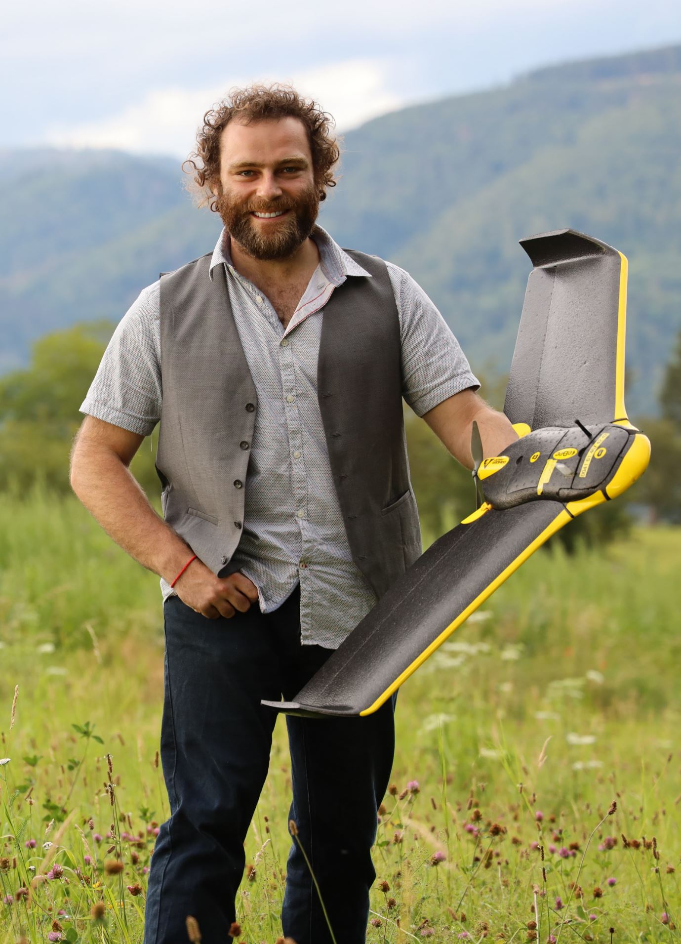
Adrian Meyer holding a fixed-wing drone in a meadow with mountains in the background.

Adrian Meyer holding a fixed-wing drone in a meadow with mountains in the background.

Image supplied by Adrian Meyer. The image creator is not separately identified.

No separate open licence was specified with the supplied file.

Portrait of Adrian Meyer against a light background.

Portrait of Adrian Meyer against a light background.

Image supplied by Adrian Meyer. The image creator is not separately identified.

No separate open licence was specified with the supplied file.
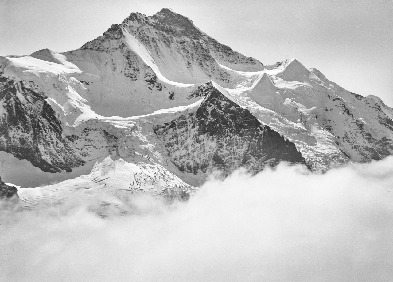
Historical balloon photograph of the Jungfrau by Eduard Spelterini, 1904.

Historical balloon photograph of the Jungfrau by Eduard Spelterini, 1904.

Eduard Spelterini / Swiss National Library, EAD-WEHR-32085-B. File supplied by Adrian Meyer.

Public domain, as identified in the Swiss National Library’s upload on Wikimedia Commons.

Screenshot of the VelObserver viewer showing a street view on Steinenring in Basel, a map inset and viewer controls.

Screenshot of the VelObserver viewer showing a street view on Steinenring in Basel, a map inset and viewer controls.

Screenshot supplied by Adrian Meyer. The street photograph’s creator is not separately identified; the inset map displays Mapbox attribution.

No separate open licence was specified with the supplied file.

Collage of digital globe views combining terrain, a balloon model, historical photographs and map layers.

Collage of digital globe views combining terrain, a balloon model, historical photographs and map layers.

Image supplied by Adrian Meyer. The image creator is not separately identified.

No separate open licence was specified with the supplied file.

Parking statistics: parked minutes by hour and weekday, divided into four user groups. The annotations and group definitions are part of the original figure.

Parking statistics: parked minutes by hour and weekday, divided into four user groups. The annotations and group definitions are part of the original figure.

Image supplied by Adrian Meyer. The image creator is not separately identified.

No separate open licence was specified with the supplied file.

Six aerial image extracts with detected photovoltaic installations. The coloured masks, detection boxes and confidence values are part of the supplied figure.

Six aerial image extracts with detected photovoltaic installations. The coloured masks, detection boxes and confidence values are part of the supplied figure.

Image supplied by Adrian Meyer. The image creator is not separately identified.

No separate open licence was specified with the supplied file.

Object detection in a civil protection shelter: reference annotations and model predictions with and without quantisation and scaling. The green highlight is part of the original figure.

Object detection in a civil protection shelter: reference annotations and model predictions with and without quantisation and scaling. The green highlight is part of the original figure.

Image supplied by Adrian Meyer. The image creator is not separately identified.

No separate open licence was specified with the supplied file.

Stored salt beneath a timber dome structure.

Stored salt beneath a timber dome structure.

Image supplied by Adrian Meyer. The image creator is not separately identified.

No separate open licence was specified with the supplied file.

Coloured raster over agricultural trial plots on a greyscale aerial image. The figure has no legend identifying the measured variable.

Coloured raster over agricultural trial plots on a greyscale aerial image. The figure has no legend identifying the measured variable.

Image supplied by Adrian Meyer. The image creator is not separately identified.

No separate open licence was specified with the supplied file.

AR BS prototype views: a digital city model in Unity and spatial overlays on the physical city model of Basel.

AR BS prototype views: a digital city model in Unity and spatial overlays on the physical city model of Basel.

Image supplied by Adrian Meyer. The image creator is not separately identified.

No separate open licence was specified with the supplied file.

Interior rendering with seating, large windows and folded curtains.

Interior rendering with seating, large windows and folded curtains.

Image supplied by Adrian Meyer. The image creator is not separately identified.

No separate open licence was specified with the supplied file.

Aerial image with a tile grid and coloured outlines over residential areas; an example of working with geospatial data and AI.

Aerial image with a tile grid and coloured outlines over residential areas; an example of working with geospatial data and AI.

Provided by Adrian Meyer.

No separate reuse licence specified.

Still from the field video: a field spectrometer is pointed towards a deer in an enclosure.

Still from the field video: a field spectrometer is pointed towards a deer in an enclosure.

Provided by Adrian Meyer.

No separate reuse licence specified.

Relative habitat suitability in winter 2019. Left: multitemporal MaxEnt using rail, road and GBIF observations for the withheld test year. Right: monotemporal, GBIF-only and gradient-boosting (GBM) comparison variants. Colors show relative suitability, not population density or calibrated occurrence probability. Meyer et al. (2026), Figure 6; CC BY 4.0.

Relative habitat suitability in winter 2019. Left: multitemporal MaxEnt using rail, road and GBIF observations for the withheld test year. Right: monotemporal, GBIF-only and gradient-boosting (GBM) comparison variants. Colors show relative suitability, not population density or calibrated occurrence probability. Meyer et al. (2026), Figure 6; CC BY 4.0.

Meyer et al. (2026).

CC BY 4.0. Full figure, converted to WebP and resized for the website. The original remains available.

Relative habitat suitability in summer 2019, using the same layout as the winter map: multitemporal MaxEnt with all three observation sources on the left; monotemporal, GBIF-only and GBM comparisons on the right. The seasonal comparison reveals changes in spatial suitability patterns. Meyer et al. (2026), Figure 6; CC BY 4.0.

Relative habitat suitability in summer 2019, using the same layout as the winter map: multitemporal MaxEnt with all three observation sources on the left; monotemporal, GBIF-only and GBM comparisons on the right. The seasonal comparison reveals changes in spatial suitability patterns. Meyer et al. (2026), Figure 6; CC BY 4.0.

Meyer et al. (2026).

CC BY 4.0. Full figure, converted to WebP and resized for the website. The original remains available.

Spatial validation of the risk models: the upper panel compares random splitting, checkerboard validation and large spatial blocks; the lower panel shows the concentration of collision-positive cells in the highest risk ranks. Meyer et al. (2026), Figure 4, preprint; CC BY 4.0.

Spatial validation of the risk models: the upper panel compares random splitting, checkerboard validation and large spatial blocks; the lower panel shows the concentration of collision-positive cells in the highest risk ranks. Meyer et al. (2026), Figure 4, preprint; CC BY 4.0.

Meyer et al. (2026).

CC BY 4.0. Full figure, converted to WebP and resized for the website. The original remains available.

From collision records to spatially tested risk rankings: data preparation, Ecogrid, seasonal response variables and model validation. Meyer et al. (2026), Figure 2, preprint; CC BY 4.0.

From collision records to spatially tested risk rankings: data preparation, Ecogrid, seasonal response variables and model validation. Meyer et al. (2026), Figure 2, preprint; CC BY 4.0.

Meyer et al. (2026).

CC BY 4.0. Full figure, converted to WebP and resized for the website. The original remains available.

Aerial imagery for ADELE: RGB and false-color infrared SWISSIMAGE data across acquisition periods and resolutions, with 50 × 50 m image tiles centered on Swiss land-use statistics reference points. The examples illustrate the distinction between land cover and land use. Meyer et al. (2025), Fig. 2.

Aerial imagery for ADELE: RGB and false-color infrared SWISSIMAGE data across acquisition periods and resolutions, with 50 × 50 m image tiles centered on Swiss land-use statistics reference points. The examples illustrate the distinction between land cover and land use. Meyer et al. (2025), Fig. 2.

Meyer et al. (2025), Fig. 2; aerial imagery: SWISSIMAGE, swisstopo.

CC BY 4.0. Full figure, converted to WebP and resized for the website. The original remains available.

What data fusion contributes: F1 scores for the five most common land-use and land-cover classes, comparing CNN variants with the full random-forest model. Below: estimated contributions of the input data to random-forest classification. Meyer et al. (2025), Fig. 8.

What data fusion contributes: F1 scores for the five most common land-use and land-cover classes, comparing CNN variants with the full random-forest model. Below: estimated contributions of the input data to random-forest classification. Meyer et al. (2025), Fig. 8.

Meyer et al. (2025), Fig. 8.

CC BY 4.0. Full figure, converted to WebP and resized for the website. The original remains available.

Seasonal risk maps for the French railway network with local views. Smoothing the response over 5 km highlights differences between winter and summer and helps identify sections for further investigation. Meyer et al. (2026), Figure 7, preprint; CC BY 4.0.

Seasonal risk maps for the French railway network with local views. Smoothing the response over 5 km highlights differences between winter and summer and helps identify sections for further investigation. Meyer et al. (2026), Figure 7, preprint; CC BY 4.0.

Meyer et al. (2026).

CC BY 4.0. Full figure, converted to WebP and resized for the website. The original remains available.

Map data: Natural Earth · Public domain

Natural Earth

The contours and woodland drawings are graphic illustrations.

Source Serif 4 & Source Sans 3

SIL Open Font License 1.1

Source Serif 4 · OFL ↗Source Sans 3 · OFL ↗

Search

Explore projects, publications and field notes.

All contributions