16 Research projects / Complete catalogue
Research
From France’s railway network to soil organisms in the laboratory: questions, methods and findings in context.
16 results
Project atlas
Zoom in to discover individual projects. Select a marker for images and details.
Zoom in with +, then drag or use the arrow keys to move. Press 0 to reset.
Markers represent public project regions or collaboration sites. Map data: Natural Earth · Public domain
France
SNCF Réseau: AI to predict wildlife collisionsSwitzerland & neighbouring regions
VelObserver: assessing cycling infrastructure with data COLLEMBOT: automated image analysis in ecotoxicology Quartierparking 2.0 / Parcandi: using private parking spaces STDL: automated analysis of aerial imagery and LiDAR data Pilote IA / ADELE: artificial intelligence for land-use statistics SolAI: automatic detection of solar-energy installations Object detection for civil-protection facility inventories Spelterini AR: exploring historical aerial photographs Logistics of road-salt supply in Switzerland Wildlife monitoring with multisensor UAV imagery UAV multispectral sensors for crop-yield estimation DRAPE: Data Rich Augmented Positioning Environment AR Basel: an interactive extension of Basel’s city modelSouth Africa
SARECO / AIT Swiss–Africa Camera-trap monitoring at Table Mountain and Constantiaberg
SNCF Réseau: AI to predict wildlife collisions
From satellite observations to seasonal risk maps and targeted field research.
 Adrian F. Meyer
 Denis Jordan
 Theo ReibelBhardwaj, M.Kneubühler, M.Morelle, K.Pretali, S.Pascal BaranMaxime GombartFlavien Viguier


VelObserver: assessing cycling infrastructure with data
Putting everyday cycling experiences on the map.


COLLEMBOT: automated image analysis in ecotoxicology
Validated springtail counting for ecotoxicological reproduction tests.
Adrian F. MeyerDenis JordanDöring, M.Feldhaar, H.Langer, M.Mair, M.Natal da Luz, T.Souza da Silva, É.Micha Wehrlivan Gestel, C. A. M.van Gestel, K.van Hall, B.van Loon, S.
SARECO / AIT Swiss–Africa
Connecting Swiss and African research and innovation networks.


Quartierparking 2.0 / Parcandi: using private parking spaces
Understanding the traffic effects of temporarily available parking.

STDL: automated analysis of aerial imagery and LiDAR data
Turning aerial imagery and LiDAR into verifiable evidence for public geospatial inventories.

Pilote IA / ADELE: artificial intelligence for land-use statistics
Combining aerial imagery and satellite time series for detailed national statistics.
Adrian F. MeyerDenis Jordan Natalie LackFacchinetti, C.Hochuli, S.Leuenberger, M.Milani, G.Schär, M.Schönholzer, M.

SolAI: automatic detection of solar-energy installations
Mapping existing solar installations from aerial imagery.
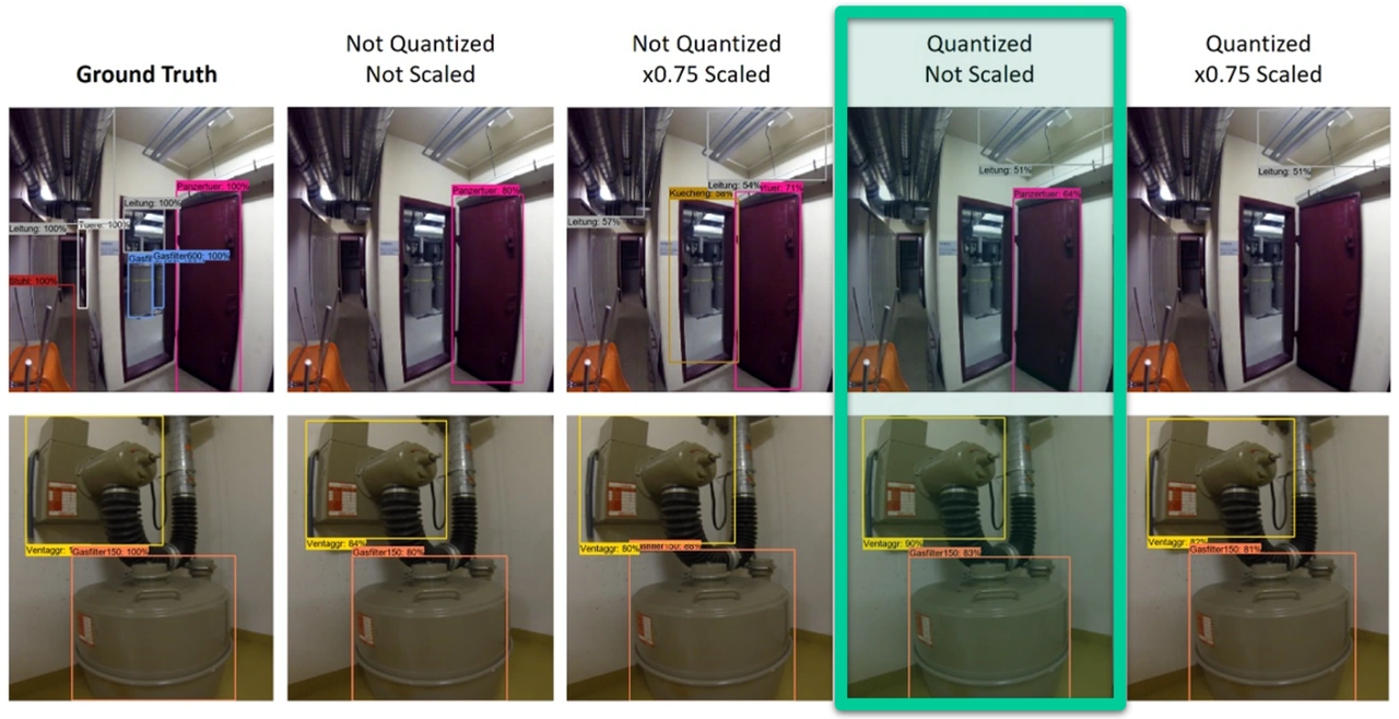
Object detection for civil-protection facility inventories
Using a smartphone to inventory civil-protection equipment.

Spelterini AR: exploring historical aerial photographs
Connecting historical aerial imagery with spatial data.
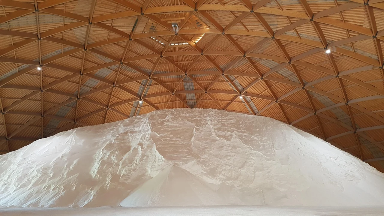
Logistics of road-salt supply in Switzerland
Understanding winter demand peaks across space and time.

Wildlife monitoring with multisensor UAV imagery
Recognising wildlife in thermal, multispectral and RGB imagery.

UAV multispectral sensors for crop-yield estimation
Connecting vegetation development seen from the air with crop yields.
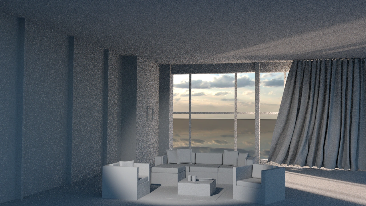
DRAPE: Data Rich Augmented Positioning Environment
Measuring and visualising made-to-measure curtains in their setting.
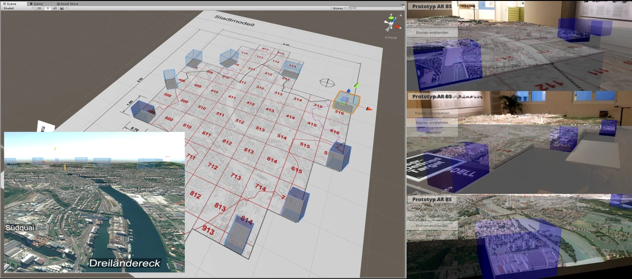
AR Basel: an interactive extension of Basel’s city model
Making city maps and models into interactive gateways to geospatial data.
Camera-trap monitoring at Table Mountain and Constantiaberg
Studying mammals and habitats at the edge of a major city.
No matching entries. Try another term or reset the filters.